


The South Island of New Zealand looks compact on a map, yet its mountain passes, winding coasts and fickle weather can turn any drive into a full day. Tourism New Zealand promotes the island around a handful of core touring routes rather than individual roads, and understanding these structures is the key to planning a realistic, flexible trip. This guide compares the island’s main route families, outlines typical driving times, and shows where to build in weather buffers so your journey feels like a holiday instead of a race against the clock.
How South Island road-trip routes fit together
Most South Island road trips start in Christchurch or Queenstown and then follow one of four broad patterns: the inland spine through Lake Tekapo, Aoraki/Mount Cook and Queenstown; the West Coast circuit via Arthur’s Pass and Haast Pass; the lower South Island loop through Dunedin and the Catlins; and northern loops connecting Kaikōura, Marlborough and Nelson. These are the same families of routes promoted in official touring maps and by visitor centres, so you will see the same names repeated when you talk to rental firms or tourism staff.
In practice, travellers usually link two or three of these patterns into one journey. For example, a classic two-week loop might run Christchurch to Tekapo and Mount Cook, continue to Wānaka and Queenstown, drop to Te Anau for Fiordland, swing through the Catlins and Dunedin, then return to Christchurch via the coastal highway. Another common choice is to combine the inland spine with the West Coast circuit, using Arthur’s Pass one way and Haast Pass the other to create a figure-eight across the Southern Alps.
The most important planning principle is to think in days, not distances. Open-road limits in New Zealand are often 100 kilometres per hour, but realistic averages sit closer to 80 kilometres per hour even in good weather, and much less on alpine passes. A seemingly simple 250 kilometre leg such as Christchurch to Tekapo routinely takes around three hours of driving plus at least another hour for fuel and photo stops. Treat official drive-time calculators as best-case scenarios and add at least 30 to 60 minutes to almost every leg.
The second principle is to plan spare days where the roads are most vulnerable to weather: the alpine passes of Arthur’s Pass, Lewis Pass, Lindis Pass and the Haast Pass corridor, and exposed coastlines such as the Kaikōura coast and parts of the West Coast. A heavy snowfall or storm does not mean you must cancel your holiday, but you may need to sit tight for twenty-four hours in a place like Tekapo, Franz Josef or Nelson while snow and slips are cleared.
One-way versus loop road trips
Choosing between a one-way trip and a loop has a bigger impact on your itinerary than any single attraction. A loop that begins and ends in Christchurch or Queenstown is usually cheaper in rental costs, easier for flights, and better for last-minute changes because you can pivot to a different route if a pass closes. For example, if Arthur’s Pass is closed by snow, a Christchurch round trip can flip to the Tekapo and Mount Cook route at short notice without extra one-way fees.
One-way trips give you more ground in less time but add cost and complexity. A common one-way pattern is to fly into Christchurch, drive south through Tekapo, Mount Cook and Queenstown, then exit from Queenstown airport. Another is to sail into Picton from Wellington, drive through Marlborough and the West Coast down to Queenstown, then fly out. Rental companies often charge one-way relocation fees between Christchurch and Queenstown or between Picton and Queenstown, which can add several hundred New Zealand dollars to a two-week booking, especially in peak summer.
Think carefully about how you want to finish your journey. Queenstown, with its compact centre and shuttle buses, is easy to enjoy without a car, so some travellers return their vehicle a day early and finish with a car-free night in town before flying out. Christchurch works similarly for urban exploring, especially if you stay near the central city and use rideshare or local buses.
For most visitors with 10 to 16 days, a broad loop is the most forgiving choice. It lets you pick up and drop off in the same city, avoid the sharpest one-way fees, and keep your options open if late snow affects the passes. You can still design your loop so you do not repeat scenery, for example by taking Arthur’s Pass westbound and returning via Tekapo and Mount Cook, or by driving the Catlins coast in one direction only.
Christchurch – Tekapo – Aoraki/Mount Cook – Queenstown
This inland spine is the route many travellers picture when they imagine the South Island: turquoise lakes, snow-capped peaks and the resort towns of Wānaka and Queenstown. From Christchurch to Tekapo is roughly 225 kilometres and around three hours of driving in good conditions. The road shifts from Canterbury farmland to rolling foothills, then climbs gently towards lake country. A fuel stop around Geraldine or Fairlie is common, particularly if you are driving a campervan that uses more fuel than a compact car.
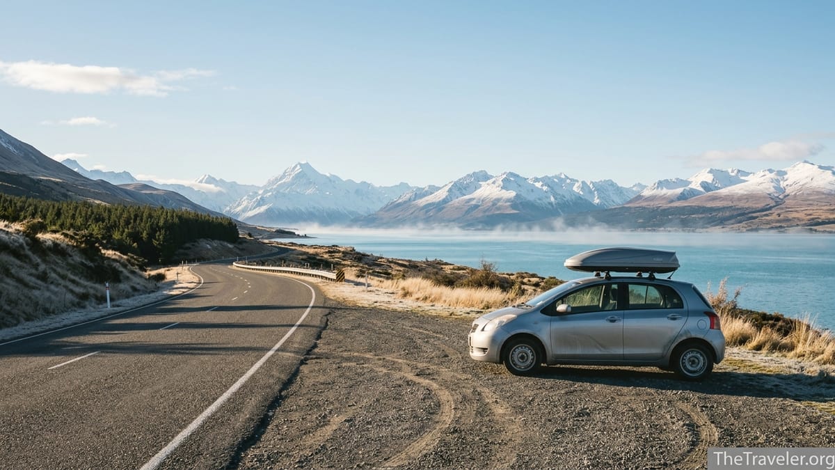
From Tekapo, many travellers continue directly towards Queenstown via the Mackenzie Basin, Lake Pukaki and Lindis Pass, while others detour off the main route to reach Aoraki/Mount Cook Village at the end of State Highway 80. The Mount Cook side road is a destination in its own right, about 55 kilometres each way along the shore of Lake Pukaki with constant views of the Southern Alps. Because Mount Cook Village has only basic services, travellers typically stock up on groceries and fuel in Tekapo or Twizel before driving in, then spend one or two nights walking short alpine tracks or taking scenic flights if the weather holds.
Driving from Mount Cook Village to Queenstown via Lindis Pass takes roughly four hours of pure driving, and from Tekapo slightly less. Lindis Pass is not as high as Arthur’s Pass but in winter it can see snow, ice and occasional closures, so carrying snow chains in rental cars or motorhomes is wise when travelling from June to September. A practical way to manage this route is to plan at least three nights between Christchurch and Queenstown: one in Tekapo, one in Mount Cook and one in Wānaka or Cromwell before the final short hop to Queenstown, giving you breathing room if a front moves through.
This inland spine forms the backbone of many tourism-board itineraries, and it connects easily with both the West Coast and the lower South Island routes. From Queenstown you can continue to Te Anau and Fiordland, or turn north towards the Haast Pass to reach the West Coast glaciers before looping back to Christchurch over Arthur’s Pass.
The West Coast circuit via Arthur’s Pass and Haast
The West Coast circuit uses State Highway 73 over Arthur’s Pass to cross the Southern Alps from Christchurch to the coast, then follows State Highway 6 south through Hokitika, glacier country and Haast before curling inland to Wānaka and Queenstown. Tourism maps call this the Great Alpine Highway and the Great Coast Road, and it is one of the island’s most dramatic combinations of alpine and coastal scenery. In raw distances, Christchurch to Hokitika via Arthur’s Pass is a little over 250 kilometres, but you should allow at least four to five hours with stops to walk short tracks and explore Arthur’s Pass Village.
Conditions on Arthur’s Pass and Porters Pass can change quickly, especially in winter and early spring. Snow, black ice and strong winds can all trigger chain requirements or temporary closures. Rental contracts often require that you avoid driving on certain alpine roads when authorities deem them unsafe, so you must check official road updates the morning you plan to cross. A flexible schedule might keep one uncommitted night either side of the pass, for example staying in Springfield or Castle Hill on the east and Hokitika or Greymouth on the west so you can adjust without losing prepaid bookings.
South from Hokitika, the West Coast road passes Franz Josef and Fox Glaciers, both popular bases for heli-hikes, short walks and scenic flights. The segment from the glaciers to Wānaka over Haast Pass is around 350 kilometres and usually takes six hours or more including stops. It is both winding and spectacular, with waterfalls, rainforest and river gorges. Summer storms and heavy rain can cause slips and closures, sometimes for a day or more while crews clear debris. Because alternative routes are long detours, it makes sense to build at least one spare day into your schedule between the glaciers and Wānaka or Queenstown.
Worked into a wider itinerary, the West Coast circuit is often combined with the inland spine in a loop: Christchurch to Hokitika over Arthur’s Pass, down the West Coast to Wānaka and Queenstown, then back to Christchurch via Tekapo and Mount Cook. With ten to fourteen days, this loop lets you sample both glacier country and high alpine basins without rushing, assuming you accept the possibility of spending an extra night or two in a place like Franz Josef or Tekapo if the passes are affected by weather.
The lower South Island through Dunedin and the Catlins
The lower South Island route runs along the east coast through Dunedin, then cuts through the Catlins coast and often links back to Queenstown or Te Anau via the Southern Scenic Route. From Christchurch to Dunedin along the main coastal highway is around 360 kilometres, often five hours of driving once you factor fuel and food stops in Timaru or Oamaru. The road is less mountainous than the alpine passes but still mostly two-lane and winding through small towns, so average speeds remain modest.
Dunedin itself rewards at least one full day, especially for travellers interested in heritage buildings, student culture and wildlife on the Otago Peninsula. South of Dunedin, the road becomes more remote as it enters the Catlins, a region of forests, bays and waterfalls between Balclutha and Invercargill. Many sections are sealed but occasionally narrow, and you may encounter gravel side roads to specific beaches or waterfalls. It is wise to top up fuel in Balclutha or Owaka before diving deep into the Catlins, particularly if you are driving a campervan with a smaller tank.
Weather along the southern coast can be raw even in summer, with strong wind, rain and low cloud rolling in off the Southern Ocean. While major closures are less common than on the alpine passes, storms can still cause surface flooding or fallen trees that slow progress. A typical pattern is to spend one night in the Catlins itself, perhaps at a small lodge or holiday park near Curio Bay or Papatowai, then one night in Invercargill or Bluff before swinging inland towards Te Anau or Queenstown. With this structure you still have leeway to add a spare night in Dunedin or the Catlins if the forecast looks poor.
The Southern Scenic Route conceptually connects Queenstown, Te Anau, Fiordland, Invercargill, the Catlins and Dunedin into a single touring corridor. Travellers with two weeks or more sometimes combine this with an inland spine trip by driving Christchurch to Tekapo and Queenstown, exploring Fiordland, then looping south through the Catlins and back up the coast to Christchurch. In such an itinerary the biggest risks to your timing are not the lower coastal sections but the alpine stages at the beginning or end, so that is where to place your weather buffers.
Northern loops through Kaikōura, Marlborough and Nelson
The northern South Island networks three distinct regions: the marine-wildlife hub of Kaikōura, the wine country of Marlborough and Blenheim, and the arts and coastal landscapes around Nelson and Tasman. These are linked by State Highway 1 along the east coast and State Highway 6 and associated roads further inland, and they slot cleanly into both North Island ferry arrivals and South Island loops. For example, a traveller sailing into Picton might spend a night in Blenheim to explore cellar doors, then drive two to three hours to Nelson before cutting down towards the West Coast or inland to Lewis Pass.
Kaikōura sits roughly halfway between Picton and Christchurch, so it is a natural stop on a longer coastal drive. The rebuilt highway south from Kaikōura still threads between steep hillsides and the sea in places, making it vulnerable to slips during heavy rain or very high seas. These weather-related closures are not everyday events but are significant enough that national transport authorities continue to advise travellers to check conditions before committing to that leg. On a Christchurch to Nelson loop you might allow a night in Kaikōura each way so that you have some flexibility to sidestep a short-term closure by reordering your stays.
Nelson and nearby towns such as Motueka and Kaiteriteri are gateways to Abel Tasman National Park and the wider Tasman region. Driving from Nelson to the West Coast via Murchison and the Buller Gorge generally takes around four hours in fine conditions. The road is winding but usually less exposed than the high alpine passes. This means northern loops often serve as a weather-friendly alternative if snow affects the centre of the island. For example, if Arthur’s Pass is closed during your planned Christchurch to West Coast crossing, you might instead drive to Nelson and then approach the coast via the more northerly routes.
Many visitors connect these northern loops to a larger figure-eight: Christchurch to Kaikōura and Picton, across to Nelson, down to the West Coast and glaciers, then inland to Queenstown and finally back to Christchurch via Tekapo. In this structure the key weather pinch-points are the Kaikōura coast and whichever pass you choose between the West Coast and interior, so placing a spare day in either Nelson or Franz Josef allows you to absorb a temporary road issue without losing core experiences.
Rental cars, alpine passes, fuel planning and weather buffers
For most travellers, a standard rental car is the simplest choice for South Island touring. All major gateways such as Christchurch, Queenstown, Dunedin and Nelson host multiple rental brands, from international chains to local firms. Compact and mid-size cars are usually sufficient; four-wheel drive vehicles are not mandatory on sealed highways, though they may add confidence in winter. Motorhomes and campervans offer freedom and combined accommodation but are slower, larger on tight corners and more affected by wind on exposed passes.
Rental contracts commonly exclude unsealed back roads and may contain clauses relating to alpine passes or the use of snow chains. When planning to cross Arthur’s Pass, Lewis Pass, Haast Pass or Lindis Pass in winter, choose a rental company that supplies chains and demonstrates how to fit them, and check that you are permitted to drive those roads when authorities deem them safe. Travellers unfamiliar with mountain driving often choose to take the TranzAlpine train between Christchurch and Greymouth during winter, then pick up a rental car on the West Coast where roads are lower and conditions may be less icy.
Fuel planning is straightforward on main corridors but becomes important around Mount Cook, the Catlins and the West Coast. Small towns such as Tekapo, Twizel, Fox Glacier and Haast usually have fuel stations, but opening hours can be limited outside peak seasons and prices are often higher than in cities. As a rule of thumb, fill up when your tank drops to half in remote regions. Electric vehicle infrastructure is growing, with public charging points in larger South Island towns and along key touring routes, but drivers of EVs still need to route carefully, particularly on stretches like Haast to Wānaka where chargers are sparse.
Weather buffers are your main protection against stress. A practical pattern for a two-week loop might include two unallocated nights, one in the first week around Tekapo, Mount Cook or Franz Josef, and one in the second week around Nelson, Queenstown or Dunedin. If all goes smoothly, you can spend those spare nights in whichever place you like most. If a pass or coastal road closes for a day, you simply slide a booking forward instead of missing must-see locations like Milford Sound, Abel Tasman or Mount Cook.
The Takeaway
Planning a South Island road trip is less about fitting every famous place onto a single map and more about understanding how the island’s route families interlock. The inland spine through Tekapo, Mount Cook and Queenstown delivers the alpine vistas many travellers dream about. The West Coast circuit wraps that experience in rainforest, glaciers and rugged sea cliffs. The lower South Island brings heritage cities and wild southern coasts, while the northern loops offer wine regions, wildlife and sheltered alternatives when the interior is snowy.
If you allow generous driving times, pick your passes according to the season, and reserve a couple of floating days to absorb weather surprises, the island’s roads reward unhurried exploration. By treating Tourism New Zealand’s core route structures as your planning framework and layering your own interests on top, you can build a journey that feels both adventurous and realistic, with enough slack to enjoy the long views rather than race the clock.
FAQ
Q1. How many days do I need for a South Island road trip?
Most travellers find 10 to 14 days is a comfortable minimum for a loop that includes Christchurch, Queenstown and at least one coast. With only a week, focus on one or two regions, such as Christchurch to Queenstown via Tekapo and Mount Cook, or a West Coast and Queenstown circuit.
Q2. Is it better to drive a loop or do a one-way trip?
A loop that starts and ends in the same city usually costs less in rental fees and gives more flexibility if weather affects alpine passes. One-way trips, such as Christchurch to Queenstown, cover more ground in less time but often attract relocation charges and leave you with fewer options if a road closes.
Q3. Which South Island routes are most affected by winter weather?
The main problem areas in winter are the alpine passes, especially Arthur’s Pass, Lewis Pass, Lindis Pass and the Haast Pass corridor, along with occasional issues on the Kaikōura coast and high country approaches to Tekapo and Mount Cook. Snow, ice and strong winds can all lead to chain requirements or short-term closures.
Q4. Do I need a 4WD vehicle to drive South Island routes?
No, you do not need a four-wheel drive for standard touring routes such as Christchurch to Queenstown via Tekapo, Arthur’s Pass or the Catlins. A well-maintained two-wheel-drive car with good tyres and snow chains in winter is sufficient for sealed highways. Only specialised back roads and ski access tracks typically require 4WD, and many of those are excluded by rental contracts.
Q5. How much driving is realistic in one day?
Allow three to four hours of wheel time as a comfortable daily average, with longer days kept for simple transit legs. For example, Christchurch to Tekapo or Nelson to Kaikōura are realistic single-day drives with time for stops. Trying to cover routes like Franz Josef to Queenstown or Dunedin to Queenstown and still sightsee fully can leave you rushed, especially in winter.
Q6. Where should I build in spare weather days?
Place at least one spare day near key alpine crossings such as Arthur’s Pass, Haast Pass or Lindis Pass, ideally based in a town like Tekapo, Franz Josef or Wānaka. A second flexible day near Nelson, Queenstown or Dunedin lets you reshuffle coastal and wine-region plans if the Kaikōura coast or inland highways are temporarily affected.
Q7. How early should I book accommodation on these routes?
In peak seasons such as December to February and during winter ski periods around July and August, book key stops like Tekapo, Mount Cook, Queenstown and Franz Josef several months in advance. For shoulder seasons, booking one to three weeks ahead is often enough, but leaving at least some nights cancellable helps if you need to adjust for weather.
Q8. Are South Island roads difficult for drivers used to the right-hand side?
Adjusting to left-hand driving takes concentration at first, particularly at intersections and single-lane bridges. However, the main South Island touring routes are sealed and generally in good condition, with clear signage. Plan shorter first days such as Christchurch to Tekapo or Queenstown to Te Anau to build confidence before tackling longer, more complex legs like Haast Pass.
Q9. Is fuel readily available on remote stretches like the West Coast and Catlins?
Fuel is available but more spaced out, and stations may keep shorter hours than in cities. Along the West Coast you will find fuel in towns such as Hokitika, Franz Josef, Fox Glacier and Haast, while in the Catlins you should top up in Balclutha, Owaka or Invercargill. Aim to refill when your gauge reaches half a tank in these regions.
Q10. Can I do these routes with an electric vehicle?
Yes, it is increasingly possible to tour the South Island in an electric vehicle, but it requires more planning. Many larger towns on the main touring routes now have public chargers, particularly around Christchurch, Queenstown, Nelson and major West Coast centres. You will still need to check charger locations in advance and avoid letting your battery run too low before long rural stretches such as Haast to Wānaka.