


Trying to see all 13 of New Zealand’s national parks in a single fast road trip is the surest way to spend your holiday staring through a windscreen instead of standing on a trail. The parks are scattered from volcanic plateaus in the central North Island to glacier and fiord country in the deep south, and what looks close on a map can be a slow, winding drive in real life. This guide focuses on how the parks are grouped geographically and how to link them into sensible regional road-trip loops, with realistic timeframes, rest days and weather buffers so you can actually enjoy the landscapes you came to see.
Understanding How New Zealand’s 13 National Parks Are Laid Out
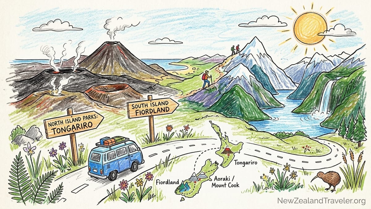
New Zealand’s 13 national parks are spread across three main regions that line up neatly with road-trip planning. On the North Island there are three: Tongariro National Park in the central plateau, Whanganui National Park draped around the Whanganui River, and Egmont National Park anchored by the volcanic cone of Taranaki. On the South Island, tourism authorities often talk about six “upper South” parks – Abel Tasman, Kahurangi, Nelson Lakes, Paparoa, Arthur’s Pass and Westland Tai Poutini – plus four “lower South” or southern parks – Aoraki / Mount Cook, Mount Aspiring, Fiordland and Rakiura on Stewart Island. That structure naturally supports several regional loops rather than one giant lap.
On a map, the country looks compact. In distance terms it is: driving from Auckland to Wellington is roughly 640 kilometres, and Picton to Queenstown is in the same ballpark. The catch is that most national-park access roads follow river valleys and mountain passes. Average speeds often sit closer to 70 to 80 kilometres per hour once you are off the main highways, even in fine weather. A day that looks like a comfortable three-hour hop between parks can stretch closer to five hours when you factor in narrow bridges, logging trucks, photo stops and rain.
Another factor is that many of the most rewarding tracks in these parks are full-day or multi-day hikes. Trying to drive into a park, complete a six-hour walk and then push on another three hours to the next park is not only exhausting, it also leaves no margin for the kind of fast-changing weather that is normal in alpine and coastal environments. A much better mindset is to treat each park cluster as its own mini-expedition, with specific access towns, accommodation bases and one or two headline walks, then to link those clusters with flexible driving days.
For planning purposes, think of New Zealand’s national parks as four logical road-trip “families”: the North Island volcanic and forest parks; the upper South Island coastal and alpine parks; the southern alpine and Fiordland loop; and the optional side trip to Rakiura for travellers with extra time or a passion for remote places and birdlife. You can combine two or three of these families into a longer journey, but the key is to leave gaps in the calendar rather than trying to tick every park in strict alphabetical order.
North Island Volcanic and Forest Parks by Car
On the North Island, a classic national-parks road trip links Tongariro, Whanganui and Egmont in a broad loop that uses the central plateau as its hub. Many visitors start or end in Auckland or Wellington, but the real pivot points for these parks are towns like Taupō, Turangi, National Park Village, Ohakune and New Plymouth. One practical version is to drive south from Auckland to Taupō, spend a few nights around Tongariro, detour into Whanganui National Park by road or river, then arc around the west coast to Egmont National Park before heading back to your starting point.
Tongariro National Park deserves at least two or three nights on its own. The Tongariro Alpine Crossing is rightly promoted as one of the country’s great day hikes, but it is a serious alpine route that can be slowed or cancelled by wind, snow or low cloud even in summer. Booking a local shuttle from National Park Village or Turangi is standard, and savvy travellers keep a spare “weather day” in the area so they can move the hike if conditions are unsafe. Shorter walks near Whakapapa Village and around Taranaki Falls or the Tama Lakes give rewarding views of the volcanoes if you are not attempting the full crossing.
Whanganui National Park feels very different from Tongariro’s exposed volcanic ridges. Access is centred on the river, with small settlements such as Whakahoro and Pipiriki acting as launch points for canoe and kayak journeys. A common pattern for road-trippers is to leave the car in Taumarunui or Ohakune, join a two to three-day guided river trip that includes hut or lodge overnights within the park, and then reconnect with their vehicle at the end. Because these trips are weather and river-level dependent, you again want some flexibility: arrive in the region a day early, and do not plan a long, fixed onward drive the afternoon you finish paddling.
Egmont National Park, surrounding the almost symmetrical cone of Taranaki, is reached via New Plymouth and a ring of small road-ends such as North Egmont and Dawson Falls. From Tongariro it is technically possible to drive to New Plymouth in a long day, but many visitors break the journey in Whanganui town or one of the west-coast villages. Local operators in New Plymouth can shuttle hikers to different trailheads so they can complete a traverse without worrying about retrieving a car. Weather here is famously changeable, with cloud racing in from the Tasman Sea, so a two-night stay gives you a much better chance of catching clear conditions for a summit attempt or a high-level circuit.
Upper South Island: Coastal and Alpine Park Loops
The six upper South Island parks form one of the most satisfying road loops in the country. They stretch in an arc from the golden beaches of Abel Tasman National Park through the karst plateaus of Kahurangi, the glaciated valleys of Nelson Lakes, the rugged limestone country of Paparoa and the high passes of Arthur’s Pass to the glacier landscapes of Westland Tai Poutini. The natural gateway for this loop is the ferry terminal at Picton or the airport at Nelson, with rental-car depots in both.
A common itinerary starts in Picton after crossing Cook Strait, then heads west to Nelson and Motueka as bases for Abel Tasman and Kahurangi. Abel Tasman is known for its coastal track, water taxis and sea kayaking, so road access is mainly about reaching trailheads such as Marahau and Wainui. Staying two or three nights in Motueka or Kaiteriteri allows you to mix day walks with a one-way coastal tramp, arranging a boat pickup to return you to your starting point. Kahurangi, by contrast, has multiple inland roadheads like Flora, Cobb and Karamea, reached by winding gravel roads that are slow in wet weather. Here you want to start early in the day, carry extra water and fuel, and avoid driving these roads in the dark if you can help it.
From Nelson Lakes, with its base villages of Saint Arnaud and Murchison, the loop can swing west along the Buller River to Westport and then south to Paparoa National Park and Arthur’s Pass, or cross directly through the Lewis Pass region before turning towards the west coast. Paparoa’s Punakaiki area is within easy reach of Greymouth or Westport, but the Paparoa Track itself starts near Blackball and ends at Punakaiki, so many hikers book shuttles. Arthur’s Pass village, smack in the middle of the Southern Alps, splits the difference between Christchurch on the east coast and Greymouth on the west. You might drive over from Nelson Lakes in one day, but the route includes narrow gorges and busy freight traffic, so realistic travellers allow a generous half-day with stops.
Westland Tai Poutini National Park lies further south along the coast, wrapping around glacier valleys such as Franz Josef and Fox. Distances between Westport, Greymouth and the glacier townships look small, yet the road clings to a wild coastline where heavy rain, temporary slips and slow-moving vehicles can all delay progress. NZTA’s online Journey Planner shows live incidents, delays and roadworks on these highways and is worth checking on the morning you plan to drive between park bases. Combining Paparoa, Arthur’s Pass and Westland Tai Poutini into one west-coast swing works well with at least a week, giving you room for one or two full hiking days, a glacier walk or scenic flight, and a buffer in case low cloud grounds aircraft.
Southern Alpine and Fiordland Loop
The southern parks of Westland Tai Poutini, Aoraki / Mount Cook, Mount Aspiring and Fiordland can be joined into a superb alpine and fiordland loop, usually starting from Christchurch or Queenstown. One practical version runs Christchurch to the glacier country on the west coast, then over Haast Pass to Wanaka and Queenstown for Mount Aspiring access, south to Te Anau and Milford Sound in Fiordland, then back across the interior via Queenstown and the Mackenzie Basin to Aoraki / Mount Cook and finally returning to Christchurch. There are other variations, but all share the same principle: never rush the mountain passes.
Aoraki / Mount Cook National Park, home to New Zealand’s highest peak, is reached via a sealed side road from the main highway between Tekapo and Twizel. From Queenstown it is technically possible to drive to Mount Cook Village in about three and a half hours in good conditions, but snow, ice and tourist traffic can easily add an hour. Many travellers break the journey with a night in the Mackenzie Basin, then spend two nights in Mount Cook Village to allow for the popular Hooker Valley Track, a half-day visit to Tasman Glacier viewpoints and a rest period. Accommodation in the village is limited compared with Queenstown or Wanaka, so it pays to book ahead in peak season.
Mount Aspiring National Park is best approached from Wanaka or the Matukituki Valley, or from the Haast side on the west coast. Roads such as Wanaka to Raspberry Creek include long stretches of gravel and fords that can be closed after heavy rain. Rental companies vary in what they allow on unsealed roads, so it is important to read your contract and, if necessary, book a local shuttle to the road-end instead of driving your own hire car beyond the sealed sections. Day walks like the Rob Roy Glacier Track rely on these access roads; allowing a spare day in Wanaka means you can shift plans if river levels are too high.
Fiordland National Park, the largest of New Zealand’s national parks, spreads across a huge swathe of the southwest, with Te Anau as its main service town and Milford Sound and Doubtful Sound as its most famous fiords. The drive from Te Anau to Milford Sound is under 120 kilometres, yet tour operators often allow two and a half hours or more each way for coaches due to narrow sections, avalanche-prone areas in winter and frequent photo stops. It is common to stay at least two or three nights in Te Anau, using one day for a Milford Sound cruise, another for a local walk such as the Kepler Track day section, and a third as a weather backup or for a Doubtful Sound excursion out of nearby Manapouri.
By connecting these southern parks in a loop, you gain flexibility: if heavy rain is forecast on the west coast, you can adjust the order of Aoraki / Mount Cook and the glacier towns, or add a rest day in Queenstown. NZTA’s Journey Planner highlights when key alpine highways, such as the Haast Pass road or the route to Milford Sound, have chain restrictions, delays or closures. Checking these updates on the morning you drive can be the difference between a long but scenic travel day and a frustrating backtrack.
Cook Strait Ferries, One-Way Rentals and Practical Driving Realities
For any road trip that includes both islands, you need to account for the Cook Strait ferry between Wellington and Picton. Interislander and Bluebridge both carry passengers and vehicles, with several sailings most days in each direction. Crossing time is usually between three and three and a half hours port to port, but you must also factor in check-in windows, sometimes up to an hour before departure for vehicles, and the time to disembark and clear the Picton or Wellington terminals. On a national-parks itinerary, this effectively makes your ferry day a dedicated travel day, not one to combine with a major hike or long additional drive.
Prices on these ferries vary by season and by vehicle size. As a broad indication, a car and two adults might pay a few hundred New Zealand dollars for a crossing in summer, while foot passengers can pay much less. Many travellers choose to book far in advance for peak holiday periods such as late December and January, when popular midday sailings can fill. It is increasingly common to book a flexible fare that can be shifted by a few hours or a day if storms or swells disrupt the schedule, especially for itineraries that hinge on tight connections with rental-car returns or domestic flights.
One-way car and campervan rentals between Auckland, Wellington, Picton, Christchurch and Queenstown give you freedom to avoid simply retracing your route, but they usually attract one-way fees. These surcharges can range from modest to significant depending on direction and date. For example, in late summer there is often a surplus of vehicles in Queenstown that rental companies want shifted north, so heading north may carry a lower or even waived fee, while driving the more popular Auckland-to-Queenstown direction might be priced higher. Checking a few different pickup and drop-off combinations can sometimes save enough to pay for several days of fuel.
Fuel itself is a meaningful line item on a national-parks road trip, especially for larger vehicles. Petrol and diesel prices in New Zealand have fluctuated in recent years in response to global markets and local taxes, and remote areas can be noticeably more expensive than big-city service stations. Before committing to very long rural stretches, such as the West Coast between Westport and Haast or the route between Te Anau and Milford Sound, it is sensible to fill up in town and carry a mental note of the next available fuel stop. NZTA’s resources also include information and maps for public EV charging, which has expanded along main tourist routes but is still sparser in some remote valleys.
Electric-vehicle travellers should build in extra margin for charging stops, especially on days with significant elevation gain. Cold weather and mountain driving both reduce range. For example, a route from Queenstown to Aoraki / Mount Cook via the Lindis Pass and Mackenzie Basin includes long stretches without high-speed chargers. Checking the latest EV charging maps before departure, and choosing accommodation that offers overnight charging, can make this type of itinerary far more relaxed. In winter, you also need to consider that slow, careful driving on icy roads will extend both your time on the road and your energy use.
NZTA Journey Planner, Mountain Road Conditions and Why Maps Lie
New Zealand’s official road information is centralised through NZTA Waka Kotahi, whose Journey Planner and highway-conditions tools show live updates on closures, incidents, maintenance and delays. Travellers can check these online maps on the morning of a drive to see if, for example, a slip has closed the coastal highway near Punakaiki or if overnight snow has brought chain requirements to the alpine passes. NZTA also publishes traffic bulletins and seasonal advice, and explicitly warns drivers not to rely solely on generic GPS or smartphone directions for estimated travel times or closure information.
Mountain roads are where the gap between map distance and real-world time becomes most obvious. The road to Milford Sound offers a classic example: at well under 120 kilometres from Te Anau, it can look like a straightforward day trip. In reality, the route passes through avalanche-risk zones, one-way tunnels and sections where heavy rain and rockfall are common. During busy periods, tour coaches, rental cars and photo stops all slow traffic. NZTA journey estimates are built on typical conditions but cannot anticipate every sudden storm or accident, which is why local operators routinely allow two and a half hours or more for the drive even in fine weather.
Similarly, west-coast highways that trace the edge of Paparoa and Westland Tai Poutini twist through gorges and past steep valleys where slips, temporary traffic lights and roadworks are regular facts of life. A nominal three-hour hop between Westport and Franz Josef can regularly stretch longer. In winter and early spring, alpine passes such as Arthur’s Pass and the route over the Crown Range near Queenstown may require snow chains or be subject to early-morning ice. Road-conditions pages will flag these alerts, but drivers still need to adjust habits on the ground, slowing for shaded corners and leaving much greater stopping distances than they might be used to in Europe or North America.
For longer trips that cross several regions, NZTA’s tools allow you to save preferred routes or sign up for alerts, which can be particularly helpful if you are driving a motorhome that cannot easily reverse sharp detours or turn-arounds. Before committing to a narrow, unsealed road-end near a park boundary, it can also be worth phoning a local visitor centre or accommodation host to ask about current surface conditions. They may know about fresh potholes or washouts that have not yet triggered an official closure but would make life difficult in a low-clearance rental car.
Building Realistic 10-Day, 2-Week, 3-Week and Month-Long Approaches
With 10 days, the most satisfying strategy is to focus on one island and one or two park clusters. A 10-day North Island trip might base you in Taupō or Turangi for Tongariro, include a two or three-day Whanganui river journey, and finish with Egmont around New Plymouth. That could look like two nights near Tongariro, two nights tied to the river trip, two nights in or near New Plymouth, plus buffer and driving days at the start and end. You would not see every corner of these parks, but you would get meaningful time on the ground rather than living out of a car seat.
On the South Island, a 10-day focus could be the upper South loop: Picton to Abel Tasman and Kahurangi, then down through Nelson Lakes to Paparoa and Arthur’s Pass before returning to Nelson or Christchurch. Here you might spend two nights near Abel Tasman, two around Nelson Lakes, two on the west coast near Paparoa or the glaciers, and two in or near Arthur’s Pass, with the remaining days as travel and buffer. This kind of trip leaves out the southern alpine and Fiordland parks entirely, but it aligns better with the reality of winding roads and unpredictable weather.
Two weeks opens the door to combining the North Island volcanic and forest parks with either the upper or lower South parks, using the Cook Strait ferry as your pivot. A realistic 14-day pattern could be four or five days split between Tongariro, Whanganui and Egmont, a travel day to Wellington and across the strait, then eight or nine days circling Abel Tasman, Kahurangi, Nelson Lakes and the west-coast parks. Alternatively, you could spend your full two weeks solely in the South, starting in Christchurch, looping through Aoraki / Mount Cook, the West Coast, Mount Aspiring, Queenstown and Fiordland, and finishing in Queenstown or Dunedin with several non-driving days built around key hikes.
With three weeks, travellers who are comfortable with steady but not frantic driving can experience national parks on both islands without constant packing and unpacking. One option is a North Island week focused on Tongariro and Whanganui, a middle week for upper South parks from Picton to Arthur’s Pass, and a final week dedicated to Aoraki / Mount Cook, Mount Aspiring and Fiordland. Each week could include at least two rest or low-activity days, perhaps spent in lakeside towns like Taupō, Nelson, Wanaka or Te Anau. If you are a keen tramper planning multi-day tracks, such as the Milford Track or the Paparoa Track, you will want to reduce the number of different parks in favour of extra nights near your chosen route.
A month-long road trip makes it feasible to reach all 13 national parks, including remote Rakiura, without rushing every step, but it still requires discipline. The most relaxed version carves the trip into four roughly week-long chapters: North Island volcanic and forest parks; upper South coastal and alpine parks; southern alpine loop; and a final chapter that includes the ferry across Foveaux Strait to Rakiura plus extra downtime in a favourite region. Even at this length, the principle remains the same: spend at least two nights, and ideally three, in each park base so your big hiking days are separated by easier ones, and always hold one or two “float days” in reserve to shift into place if storms disrupt your plans.
The Takeaway
New Zealand’s national parks reward curiosity, patience and a willingness to slow down. Planning your road trip around regional park clusters, rather than a frantic race to collect all 13, helps you match the country’s geography and infrastructure instead of fighting them. That means taking maps with a pinch of salt, understanding that mountain roads and coastal highways consume more time and attention than their kilometre markers suggest, and giving yourself generous buffers when ferries, river trips or alpine hikes are involved.
The practical tools are straightforward. Use NZTA’s Journey Planner and highway-conditions pages before each driving day, speak with local visitor centres about current access roads, and read your rental-car or campervan contract closely before venturing onto gravel road-ends. When you cross Cook Strait, treat the ferry as a full travel day rather than a quick hop. Build your itinerary around a few anchor parks on each island, linked by logical loops, and stay long enough in each base to rest, reset and wait out poor weather. That is how you swap a rushed checklist for a genuinely memorable road trip through some of the most varied park landscapes on earth.
FAQ
Q1. Can I realistically visit all 13 national parks in two weeks?
In two weeks you could physically drive to most parks, but you would spend far more time on the road than on the trails. A better plan is to focus on one island and two or three park clusters, or accept that some parks will be scouting visits rather than deep explorations.
Q2. How far in advance should I book the ferry between Wellington and Picton?
For peak summer months and school holidays, it is sensible to book car spaces several weeks to a few months ahead, especially for midday sailings. In shoulder seasons you might secure spots closer to departure, but flexible tickets still give you peace of mind if weather disrupts the schedule.
Q3. Is it worth hiring a one-way rental car for a national parks road trip?
One-way rentals often cost more, but they can save you several days of backtracking, which is particularly valuable on shorter trips. Compare the one-way fee with the fuel, time and extra accommodation required to return to your original pick-up point before deciding.
Q4. How many nights should I plan in each park area?
A practical minimum is two nights per park base, which gives you one full day without driving, plus arrival and departure days. Keen hikers aiming for big day walks or overnight tracks usually prefer three or more nights so they can build in a weather buffer.
Q5. Are New Zealand’s mountain roads difficult for drivers used to wide highways?
Many visitors are surprised by how narrow and winding New Zealand’s state highways feel, especially in alpine and coastal areas. With sensible speeds, extra following distance and regular rest stops, most confident drivers adapt quickly, but it is important not to schedule long, late-night mountain drives.
Q6. Can I do the Tongariro Alpine Crossing and still drive to another park the same day?
It is technically possible, but not advised. The Crossing is a demanding full-day hike, and combining it with a long drive to another park leaves no room for delays or fatigue. Most travellers sleep near Tongariro both the night before and the night after the hike.
Q7. How reliable is mobile coverage inside the national parks?
Coverage is patchy or non-existent in many valleys and on remote tracks, particularly in Fiordland, Mount Aspiring, Kahurangi and parts of Westland Tai Poutini. Download offline maps, carry paper back-ups and let someone know your plans when heading into more remote areas.
Q8. Is an electric vehicle practical for a multi-park road trip?
EV travel is increasingly feasible on main routes, with public chargers in larger towns and tourist centres, but planning is essential. You may need to adjust your route slightly to align with charging locations and choose accommodation that offers overnight charging, especially in alpine regions.
Q9. Do I need to book hikes and huts in advance?
For popular Great Walks and certain serviced huts, advance bookings are essential in the main hiking season and can sell out months ahead. Shorter day walks and many basic huts remain first-come, first-served, but local visitor centres can clarify current booking rules for each area.
Q10. What is the best season for a national parks road trip by car?
Late spring, summer and early autumn offer the most stable road and trail conditions, with long daylight hours and reduced risk of snow and ice. However, these periods are also busier, so booking key accommodation, ferries and guided activities ahead of time is strongly recommended.