


New Zealand’s Great Walks get plenty of attention, but the country’s national parks also hide an outstanding network of day hikes that do not require a hut booking or carrying overnight gear. Over several seasons of walking across both islands, I focused on single-day routes that start and finish at the road or a shuttle stop, then kept only the ones I would genuinely consider repeating. This guide is built on that firsthand shortlist, along with one famous hike I would skip next time and one quieter trail that surprised me in all the right ways.
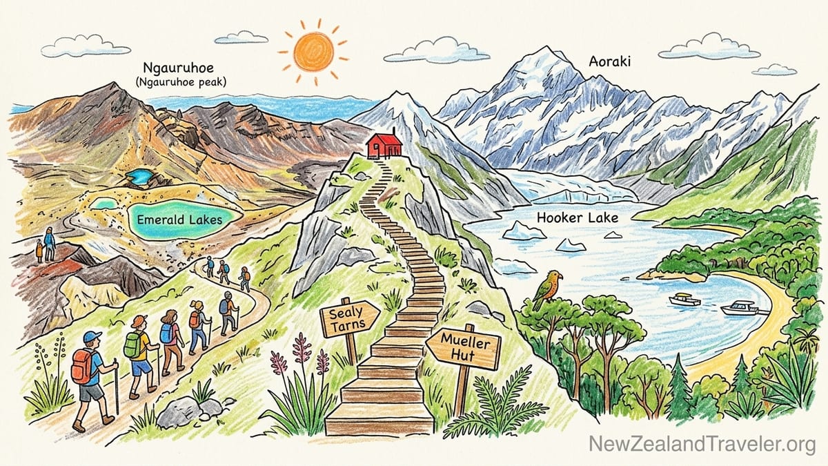
How I Chose And Walked These Day Hikes
For this article I set a simple rule: I had to complete every trail before giving it a verdict. That meant walking the full Tongariro Alpine Crossing, climbing to Sealy Tarns and on to Mueller Hut on a clear day, looping up and down Avalanche Peak in Arthur’s Pass, exploring day sections of the Routeburn and Abel Tasman tracks, and sampling alternative coastal and rainforest options on the West Coast. I walked most of these in the main hiking seasons of 2023 to 2026, usually in late summer or early autumn when daylight is long and weather is somewhat more stable, but still changeable enough to matter.
I relied largely on Department of Conservation visitor centres and official track pages for distances, elevation profiles and safety updates. For example, the Tongariro Alpine Crossing is now listed at about 20.2 kilometres one way with around 1,200 metres of ascent and descent, and DOC’s Avalanche Peak route guide in Arthur’s Pass still advises allowing six to eight hours for the roughly 1,100 metres of vertical gain from the village to the 1,833 metre summit and back. These official figures matched closely with my own GPS logs once minor route variations were accounted for.
Because conditions in New Zealand’s mountains change quickly, I also paid close attention to weather, track alerts and shuttles. For Tongariro I booked a shuttle several days ahead and adjusted my chosen day within a flexible week-long window to line up with a kinder forecast. In contrast, Hooker Valley and Sealy Tarns in Aoraki Mount Cook National Park could be decided the evening before, checking the latest forecast in the village and simply driving to the White Horse Hill car park if the morning dawned clear enough.
Throughout this piece I mention approximate start times, track distances, elevation gain, toilet and water access, and how busy each trail felt. These are not hard rules so much as real-world examples: the difference between starting Tongariro at 6.30 am versus 8.30 am, or doing Avalanche Peak under high cloud versus full sun, can change a day from type-one fun to a brutal slog. Treat them as practical benchmarks when planning your own walk.
Tongariro Alpine Crossing: Volcanic Classic With Caveats
I started the Tongariro Alpine Crossing from Mangatepopo around 6.45 am on a calm March morning. My shuttle dropped me at the lower car park, where there are toilets and information boards, and I carried three litres of water since the Department of Conservation explicitly states that streams on the route are not treated and should not be relied upon for drinking. The official distance is now about 20 kilometres point to point, with roughly 1,196 metres of combined ascent and descent between Mangatepopo and Ketetahi. My GPS logged just over 21 kilometres, including a short detour for views.
The day unfolded in three distinct acts. The first section over boardwalks and gentle gradients to Soda Springs felt almost leisurely, with the first light catching Ngauruhoe and only a handful of early hikers around. After the last toilet at Soda Springs, the climb up the Mangatepopo Saddle and the zigzags to Red Crater turned the walk into a true alpine ascent. Strong gusts were already scouring the ridge by 10.00 am, and the infamous loose volcanic scree on the descent from Red Crater towards the Emerald Lakes required careful footwork. By late morning, as I traversed the central crater, the track had filled out behind me into a continuous ant trail.
Logistically, the Crossing is a one-way hike. In summer, car parks at both road ends are subject to four-hour limits for people attempting the full route, so the standard approach is to park at Ketetahi and use a private shuttle to get to Mangatepopo, then walk back to your vehicle. That is what I did, booking an early slot so I could be on the track before the taxi-style rush. Toilets are spaced at both road ends and at Soda Springs, the South Crater and Ketetahi shelter, but there is no drinking water provided along the trail. I finished at Ketetahi around 2.15 pm, so about seven and a half hours including several unhurried photo stops.
The Department of Conservation describes the Tongariro Alpine Crossing as an advanced day hike, and in good clear weather that felt accurate but not overstated. The difficulty comes more from exposure to wind and the sustained descent on loose soil than from technical scrambling. For fit hikers used to long days the challenge is manageable, but the crowds and strict shuttle logistics mean it does not feel like a wild backcountry experience. It is a hike I am glad I have done once for its extraordinary volcanic landscapes. However, this is also the one famous trail in New Zealand that I personally would not rush to repeat, especially when there are quieter alpine days elsewhere with equal or better scenery and far fewer people.
Hooker Valley Track: Effortless Glacier Views Worth Repeating
Hooker Valley, in Aoraki Mount Cook National Park, is New Zealand’s most deservedly popular easy day hike. I walked it on a clear April morning, starting from the White Horse Hill car park just after 8.00 am when there were still spaces available and the first tour buses had not yet arrived. The track to the Hooker Lake viewpoint is roughly 10 to 11 kilometres return with only modest elevation gain, generally cited at under 200 metres spread over gentle undulations and short stair sections.
The path is beautifully constructed, with wide gravel sections, boardwalks over marshy areas and three long swing bridges across the Hooker River. A new bridge added in 2026 slightly altered the route and cemented the track’s reputation as an accessible glacial walk, while also meaning parts of the path can occasionally close for maintenance. Toilets are available at the car park and near the second bridge, and there are several benches along the way, but you need to carry your own drinking water. I took two litres, wore light layers and trail shoes rather than heavy boots, and never once wished for more technical gear.
By mid-morning the track felt pleasantly busy rather than crowded, a mix of families, older walkers and photographers adjusting tripods to capture the sharp pyramid of Aoraki reflected in tarns. I reached the Hooker Lake picnic area after about 90 minutes of steady but unhurried walking, with plenty of stops to watch small avalanches tumbling off the distant faces of Mount Sefton and to snap photos of the milky glacier-fed river. The scene at the lake itself, with icebergs drifting in front of the glacier and Mount Cook looming overhead, is one of the most rewarding low-effort views anywhere in the country.
Officially, the Hooker Valley Track is graded as an easy walk and that aligns perfectly with my experience. There is little risk for prepared walkers beyond standard alpine weather changes: even in shoulder season I carried a waterproof jacket, hat and gloves, since conditions can switch from warm sun to icy wind in an hour. If there is one trail in New Zealand I would happily repeat every time I pass through Mount Cook Village, this is it. The combination of straightforward logistics, reliable parking outside of peak midday hours and an astonishing scenery-to-effort ratio makes Hooker Valley my top recommendation for new visitors and for anyone wanting an accessible but unforgettable day out.
Sealy Tarns And Mueller Hut: Staircase To The Sky
From the same White Horse Hill car park, the Sealy Tarns and Mueller Hut route offers a completely different character of day. I set off at 7.30 am on a cool, clear February day specifically to avoid climbing in the full heat of the afternoon. The Sealy Tarns Track climbs steeply from near the Hooker Valley junction to alpine tarns with broad views over the Hooker and Mueller valleys. Official estimates put the Sealy Tarns section at about 1.8 to 2 kilometres one way, with around 500 to 600 metres of elevation gain, much of it on well-built wooden steps.
Reaching the tarns took me just under 90 minutes at a steady, lung-testing plod, with only a couple of brief stops to catch my breath. There is no toilet or water on the track, only at the car park below, so I treated this as a true alpine outing, carrying trekking poles, three litres of water and full rain and wind layers despite the clear sky. The reward at the tarns is immense. The benches looked out over an inversion of Hooker Valley, which I had walked the previous day: tiny figures tracing the flat valley floor while I sat at eye level with Mount Sefton’s hanging glaciers.
On that particular day I chose to continue past Sealy Tarns on the unformed but poled route to Mueller Hut, turning the outing into a full alpine day. From the tarns to the hut is another 2 to 2.5 kilometres and roughly 600 metres of steep gain over rocky terrain and snow patches, bringing the total ascent for the day to around 1,200 metres. Although Mueller Hut is part of an overnight route, it can be visited as a strenuous day hike in good weather if you start early enough and build in generous time to descend. I reached the hut shortly before midday, spent 40 minutes soaking up a panorama of the entire Mount Cook range, then descended the same way, returning to the car park around 4.00 pm.
The Department of Conservation grades Sealy Tarns as an advanced day walk and the full Mueller Hut route as a demanding tramping track. I found that description slightly conservative for the Sealy Tarns section, which is extremely steep but never technically difficult. However, the combined ascent, exposure and changeable alpine conditions make the extension to Mueller Hut feel at least as serious as Avalanche Peak or the Tongariro Crossing. This is a day I would gladly repeat when conditions line up. For strong hikers who want a single, huge mountain day without carrying overnight gear, Sealy Tarns plus Mueller Hut offers one of the best vertical workouts and view-packed ascents in the country.
Avalanche Peak: South Island’s Toughest Classic Day Hike
Avalanche Peak, in Arthur’s Pass National Park, is one of the few national park peaks in New Zealand with a marked route all the way to the summit. The Department of Conservation’s material and the park’s dedicated route guide both highlight that the climb from Arthur’s Pass village to the 1,833 metre summit involves about 1,100 metres of vertical over a very short horizontal distance, and to allow six to eight hours for the full trip. My round outing, climbing up the historic Avalanche Peak Track and descending via Scott’s Track, took just over seven hours including an extended summit break and time to photograph kea that obligingly strutted in front of the views.
I began from near the Arthur’s Pass Visitor Centre shortly after 8.30 am under high, thin cloud and light wind, conditions that turned out to be close to ideal. The first hour climbed relentlessly through beech forest on a steep, rooty path that rarely relented. There are no toilets after leaving the village and no reliable water sources, so I carried around three litres and enough food for a full alpine day. As the trail broke the bushline, the route followed orange markers and then snow poles along a narrowing ridge. The drop-offs became more serious, the wind more insistent and the sense of remoteness very different from the crowds of Tongariro.
From the summit, the view of the surrounding Southern Alps, including Mount Rolleston and the braided Waimakariri and Bealey river valleys, was among the finest on any New Zealand day hike I have done. On the descent via Scott’s Track, which is marginally less steep but still demanding on tired legs, I met only a handful of other parties. Even on a calm summer day the track felt serious, with a clear sense that a change in weather could quickly turn it hazardous. Several incidents and fatalities over the years underline that reputation and are mentioned in route descriptions and local information boards.
The official classification of Avalanche Peak as a challenging tramping route felt entirely accurate, and in some conditions I would consider it harder than the Tongariro Crossing. The technical difficulty remains within reach of experienced hikers comfortable with loose rock and exposure, but the combination of steepness, lack of facilities and potential for rapid weather changes means it is not a casual outing. Despite, or perhaps because of, that intensity, Avalanche Peak is very much a trail I would hike again, and it stands out as my pick for the best hard single-day challenge in the South Island national parks.
Routeburn And Key Summit: Day-Trip Tasters Of A Great Walk
While full multi-day traverses of the Routeburn and other Great Walks are outside the scope of this article, several sections work beautifully as standalone day hikes. I have walked from the Routeburn shelter to Routeburn Flats and on separate occasions taken the side trip to Key Summit from the Milford Road, treating both as single-day out-and-back routes. Each gave a surprisingly complete taste of Fiordland’s deep valleys, mossy forest and high ridgelines without committing to an overnight booking.
From the Routeburn shelter, the track to Routeburn Flats is roughly 13 kilometres return with gentle gradients and an elevation gain of a few hundred metres. I started at 9.00 am on an overcast January day, with light drizzle that amplified the deep greens of the beech forest. The wide, benched trail crossed swing bridges over clear rivers, passed small side streams and opened out onto the grassy flats after about two and a half hours of steady walking. There are toilets at the shelter and at the Routeburn Flats hut, along with tank water that DOC recommends treating. As a day visitor I carried my own. The track is officially graded as an easy to intermediate Great Walk standard, which matched my impression; the main constraints are time and weather rather than technical difficulty.
Key Summit, accessed from the Divide car park on the Milford Road, is shorter but steeper, and I found it more rewarding as a standalone viewpoint. The walk to the summit and back is about three hours return for roughly seven kilometres, with an elevation gain in the vicinity of 400 metres. I set out mid-afternoon on a patchy spring day and reached the alpine tarns in just over an hour, with cloud boiling around the surrounding tops. Boardwalks and well-graded earth tracks make the ascent straightforward for anyone with moderate fitness. Toilets are available at the Divide car park, but there is no water on the track, and parking can fill quickly in peak season so arriving before late morning or later in the afternoon works best.
Both of these day sections confirmed the Routeburn’s reputation without requiring a heavy pack. Difficulty ratings felt accurate, though Key Summit is often underestimated by drivers who hop out in casual shoes without jackets. Several people I saw that day turned around well below the top when cloud and wind rolled in. If you have limited time in Fiordland and want one half-day outing that combines forest, tarns and views into deep glacial valleys, Key Summit earns a strong place on the repeat list.
Coastal And Rainforest Alternatives: Abel Tasman And Paparoa
Not every national park day hike in New Zealand is about steep alpine passes. On the northern tip of the South Island, Abel Tasman National Park offers a very different style of walking, threading golden beaches, granite headlands and coastal forest. I have walked several day sections of the Abel Tasman Coast Track, using water taxis to access points between Marahau, Anchorage, Bark Bay and Torrent Bay. A typical example was a day from Marahau to Anchorage, about 12 kilometres one way with undulating but moderate gradients and perhaps 200 to 300 metres of cumulative ascent, which took me four hours including beach stops.
On that day I left Marahau just after 9.00 am at low tide, timing my start to suit the tidal crossing at the beginning of the track. Toilets were available at Marahau and again at Anchorage, along with limited facilities at some intermediate bays. There was no treated water en route, so I carried two litres and refilled at Anchorage campground taps, treating the water before drinking. Crowd levels fluctuated with school holidays and cruise-ship schedules, but even on a busy February weekend the track never felt as congested as Tongariro. The Department of Conservation promotes Abel Tasman sections as easy to intermediate, which felt fair, with the main hazards being sun exposure and misjudged tides at estuary crossings.
On the wilder West Coast, Paparoa National Park is usually associated with its multi-day Great Walk high on the Paparoa Range. However, there are shorter rainforest and limestone gorge walks that work well as day trips. I explored the lower end of the Paparoa Track on a misty November afternoon, walking an out-and-back section from the Smoke-ho car park for around four hours. This gave a sample of lush podocarp forest, swing bridges across gorge rivers and glimpses of the escarpment route used by overnight trampers. Official information described this low-level section as intermediate grade with steady but not severe gradients, which matched what I found.
These coastal and rainforest routes are where I found my most pleasant surprise: a less-famous Paparoa day walk that linked rainforest trails with viewpoints over the escarpment. It lacked the headline status of Abel Tasman or Tongariro but delivered a richer sense of West Coast atmosphere: dripping moss, booming surf in the distance and the calls of native birds rather than the chatter of large guided groups. It is precisely the type of track I would happily repeat as a recovery day between bigger alpine efforts.
Firsthand Verdicts: What I Would Actually Hike Again
After several seasons of testing these routes, a few clear categories emerged from my own experience. For an easy day hike that almost anyone with comfortable walking shoes can enjoy, Hooker Valley stands out as the best choice. The combination of good parking at White Horse Hill, clear Department of Conservation wayfinding, boardwalks, toilets and world-class glacier scenery for a return walk of around three hours makes it a trail I recommend to friends of all ages. Starting before 9.00 am or after 3.00 pm kept crowds manageable and still left enough daylight for unhurried photography at Hooker Lake.
At the opposite end of the spectrum, Avalanche Peak earned my vote as the best hard day hike. Compared with Tongariro, it offers more solitude, a more sustained climb and a more traditional South Island tramping feel, all packed into a similar seven-hour window from car park to summit and back. The lack of on-track facilities and the need for self-sufficiency make it unsuitable for casual tourists, but for experienced hikers comfortable with exposure and route finding, it is a highlight I would absolutely repeat on another calm day.
For the best views from a single-day effort, Sealy Tarns with the optional continuation to Mueller Hut takes the crown. The direct, step-heavy climb delivers an almost continuous expansion of the panorama over Aoraki Mount Cook National Park, culminating in a 360-degree vista from the hut that rivals anything available on longer multi-day circuits. It is steep and the descent can be punishing on knees, but starting by 7.00 or 8.00 am and building in generous rest stops turned it into a sustained but manageable outing rather than a race.
In the coastal category, Abel Tasman’s day sections between Marahau and Anchorage or Bark Bay provide the best combination of beaches, native bush and logistical simplicity through water taxis and clear tidal information. For volcanic landscapes, Tongariro’s central craters and Emerald Lakes remain unmatched, even if I would not personally repeat the Crossing itself given the crowds and strict shuttle timing. If a reader can only choose one trail and wants an iconic experience that balances effort, logistics and scenery, my overall pick would be Hooker Valley. For strong hikers seeking a deeper challenge, pairing Sealy Tarns and Mueller Hut or Avalanche Peak with a more relaxed coastal day in Abel Tasman or Paparoa makes for a well-rounded New Zealand national park itinerary built entirely around day hikes.
FAQ
Q1. Do I need to book shuttles in advance for the Tongariro Alpine Crossing?
For most of the main summer season, shuttle operators strongly encourage or require advance bookings, especially for early departures between about 6.00 am and 8.00 am. Same-day spots sometimes appear in shoulder season or on less popular midweek days, but relying on last-minute availability is risky if you have only one day in the area.
Q2. Is Hooker Valley suitable for children and less experienced walkers?
Yes, Hooker Valley is one of the most family-friendly national park day hikes in New Zealand. The track is wide, well graded and mostly flat, with toilets at the car park and partway along. Children who are used to walking for two to three hours with breaks usually manage it comfortably, as long as they have warm layers and plenty of snacks.
Q3. How early should I start Sealy Tarns or Mueller Hut to avoid the worst of the heat?
On clear summer days I recommend leaving the White Horse Hill car park between 7.00 and 8.00 am. Most of the climb is in full sun, and starting early reduces both heat stress and crowding on the narrow staircase sections. If you plan to continue to Mueller Hut and back in a day, an early start also builds in a safety buffer for changing weather.
Q4. Is Avalanche Peak too dangerous for solo hikers?
Avalanche Peak is serious but not inherently unsafe for experienced solo hikers who choose a good weather window, carry a map and extra layers, and are comfortable turning back if conditions deteriorate. The route is well marked above the bushline, but there are steep drop-offs and exposure to wind. Beginners and those unfamiliar with New Zealand alpine terrain are better off joining others or choosing easier options first.
Q5. Can I sample the Routeburn or Abel Tasman tracks without overnight bookings?
Yes, several sections of both the Routeburn and Abel Tasman Coast Track work very well as day hikes. From the Routeburn shelter you can walk to Routeburn Flats and back, while in Abel Tasman you can use water taxis to create one-way coastal days between Marahau, Anchorage and Bark Bay. Day walkers share the track with overnight trampers but do not need hut or campsite bookings as long as they return to road-access points.
Q6. Are there toilets and water available on these hikes?
Facilities vary by track. Tongariro has toilets at both ends and at several points along the route but no treated drinking water. Hooker Valley offers toilets at the car park and near the second swing bridge. Many Great Walk standard tracks, such as Routeburn and Abel Tasman sections, have toilets at huts and larger campsites. In all cases it is wise to start with plenty of water and assume that any found en route will need treating.
Q7. How closely do official difficulty ratings match real-world experience?
In my experience, Department of Conservation ratings are generally accurate but can feel conservative or optimistic depending on your background. Easy and Great Walk standard tracks such as Hooker Valley and Abel Tasman sections felt correctly graded. Advanced and alpine routes like Avalanche Peak, Sealy Tarns plus Mueller Hut and Tongariro can feel significantly harder than visitors expect if they come from lowland areas or walk primarily on paved paths.
Q8. What footwear and gear do I need for these national park day hikes?
For easy graded tracks such as Hooker Valley and coastal Abel Tasman sections, sturdy walking shoes with good grip are usually enough, combined with a waterproof jacket, warm layer, hat, sunscreen and at least one to two litres of water. For alpine routes like Tongariro, Avalanche Peak, Sealy Tarns and Mueller Hut, I strongly recommend proper hiking boots or supportive trail shoes, trekking poles, three litres of water, gloves, a warm hat, and extra layers, even if the forecast is good.
Q9. How can I avoid crowds on the most popular trails?
Timing and choice of trail make the biggest difference. On Tongariro, booking one of the first shuttles of the day and starting around sunrise helps you stay ahead of the main flow. On Hooker Valley and Abel Tasman, starting before 9.00 am or in the later afternoon reduces congestion. Choosing slightly less famous alternatives, such as Paparoa rainforest sections instead of the busiest Abel Tasman bays, can also provide a quieter experience.
Q10. If I only have time for one day hike in New Zealand, which should it be?
If you want the most impressive scenery for the least logistical hassle and physical strain, I would choose Hooker Valley in Aoraki Mount Cook National Park. It combines a straightforward return route, accessible parking, clear wayfinding and some of the country’s best glacier views. Stronger hikers who prefer a tougher challenge could opt for Sealy Tarns plus Mueller Hut or Avalanche Peak instead, but Hooker Valley remains the most universally rewarding single-day choice.